

Disaster Myths
Six years ago, a tsunami obliterated South Asia's coastal towns, killing over a quarter of a million people. With Haiti's earthquake on our minds, we republish Seth R. Reice's thoughtful article on natural disasters from issue 14.
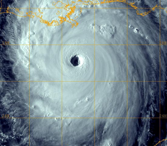
At 7:58 am GMT on December 26, 2004, a magnitude-9 earthquake—the most powerful recorded in forty years—struck deep beneath the Indian Ocean off the coast of the Indonesian island of Sumatra. The India tectonic plate sliding under the Burma tectonic plate raised the ocean floor by several metres. This lurch forced the water upward and outward across thousands of miles, triggering a mammoth, wall-like wave.
The speeding tsunami—which at its highest soared to over thirty feet—walloped densely populated coastal towns from Indonesia to Somalia. Beachfront huts were flattened. Hotels and large buildings were swatted away. Boats were flung ashore; landmines from Sri Lanka’s civil war were dislodged and swept out to sea; furniture, corrugated roofing, refrigerators, fishing rafts and, of course, corpses floated along like bath toys. The waves battered the shore for three hours.
As this article goes to press, the death toll stands at 280,000 people (a tally that includes nearly a generation of South Asian children), with an estimated 5 million others injured and homeless. (In Thailand, close to half of the 5,300 known dead and half of the 3,100 missing are foreign tourists.) It was a natural disaster in the purest sense: unpredictable and extreme. The region’s last major tsunami took place over a century ago, following the eruption of the Krakatoa volcano in 1883, so these communities—today reduced to rubble, debris and mud—had no real experience with sea surges of such size, and were given, as we now know, no advance warning.
The stories of survival that have emerged over the past month share a compelling coincidence. One family disliked their beachfront hotel in Phuket and moved a little way inland to a hotel on higher ground. They were spared, while the beachfront hotel was demolished. (Those with ground-floor rooms likely drowned; those on the upper floors had a better chance.) And then there is the monk who decided to hold services in the foothills instead of at the usual ocean-facing temple. His congregation pulled through. The temple, however, did not.
On the face of it, the reasons why some remained among the living while others did not seem utterly arbitrary. Many of us, struggling to make sense of so indiscriminate an event, have tried to explain it as an act of divine displeasure or absence. (Salman al-Farizi, the leader of the Aceh branch of one of Indonesia’s most radical Islamist groups, is in no doubt about why his home was devastated: “The Acehnese had betrayed Allah.”) Yet while the choices these survivors made may appear random, and their survival otherworldly, there is an inescapable logic to the outcome. When the great wave slammed, people’s fates were determined by where they happened to be. Cities and towns along the coastlines were hit hard. Inland and hillside villages saw no direct effects. What mattered most, to borrow the realtor’s mantra, was location, location, location.
THE REAL PROBLEM
Scientists have come to understand that natural disasters are essential for the health of natural communities—and by “communities,” I mean all the organisms (microbes to plants, animals to people) that live in a given area. Fires, floods, hurricanes and tsunamis reinvigorate natural communities by boosting biodiversity. And a boosted biodiversity results in better ecosystems: fresher air, cleaner water, improved green plant growth and so forth. So ironically, communities that suffer moderate “disturbances” will continue to consistently and efficiently deliver ecosystem services. Such fully functioning ecosystems also give us the best insurance against nature’s worst blows. During the tsunami, man-grove forests and coral reefs—which have been relentlessly destroyed to make room for hotels and holiday resorts—could have saved lives by breaking the full force of the waves; and indeed, areas that were naturally insulated suffered far less than those with barren and exposed beaches. In other words, natural disasters are not merely common, but vital. The key question for all of us is how we can learn to live with them.
To begin, we must grasp why some areas run a greater risk than others of being hit. However unpredictable their movements, natural disasters are not entirely capricious in the damage they cause. Coastal areas along oceans are in greater jeopardy than inland areas from hurricanes (which are more frequent than tsunamis). Odds are that beachfront houses will be washed out to sea far more often than third-row cottages. Those who want to live near the ocean should consider whether a view of the waves is compensation enough for the threat of their home being swallowed by a storm. Yet few people recognize or make such considerations.
This threat will only grow as global warming continues. Increases in global temperature, due to the buildup of CO2 in the atmosphere, are causing the polar ice caps to melt, which in turn raises sea levels. We’ve all heard that story, but few people realize that warmer water takes up more vol-ume than colder water, contributing significantly to this rise. The thermal expansion of the ocean increases the danger for low-lying coastal communities—not only because of the rising sea level, but because more and more people are living in these areas. Already, 50 percent of the world’s population lives within sixty kilometres of the coast—and that number is only expected to increase. The cost of waterfront property is about to get much higher: people may soon be paying with their homes—and their lives.
GET USED TO IT
Poor disaster planning is a looming crisis for more than just coast dwellers. Flooding rivers—triggered by more rainfall or snowmelt than a river channel can contain—can cause major destruction to towns and cities. In July 1996, Quebec received a full month’s worth of rain in just two days. This caused the Saguenay River to surge, washing out thousands of homes, roads and bridges, and causing at least ten deaths and an estimated one billion dollars in damages. It was the most devastating flood in Canadian history. And already this year, the Ohio River rose nearly two metres above the flood stage in January, displacing thousands of people in Kentucky, West Virginia, Ohio, Indiana and Illinois.
We may need to get used to these stories. Here’s why: The low-lying area adjacent to a river, where floods usually occur, is called the “flood plain.” A standard measure for the flood plain is the hundred-year flood mark (the height to which the river is expected to rise during the worst flood in one hundred years). Many communities have zoning ordinances that prevent construction in the flood plain. But as people continue to develop the river basin, or catchment (the area which drains into the tributary streams and, ultimately, into the river), they build more roads, houses, shopping centres and parking lots. This increases the area in the catchment that is impervious to the percolation of water. And the increase in solid surfaces means that the soil that absorbs most of the rainfall is now covered (by concrete and roofs). So where does the excess water go? It runs off into the river. This increased runoff means that the river floods more frequently, and to higher stages, than ever before.
As a consequence, most of the old hundred-year flood marks in North America are now invalid. The old flood-plain maps place them far lower (and closer to the stream or river) than they actually are today. In fall 1999, during Hurricanes Dennis and Floyd, North Carolina’s Tar River exceeded the existing hundred-year flood mark three times in two weeks. This means that homes and businesses previously considered safe are now highly vulnerable to flood damage. The good news is that many counties in the US are in the process of redrawing and updating their flood-plain maps. That the peril of flood damage diminishes as one moves upslope may sound self-evident, but clearly it’s not. Sound zoning needs to insist on prohibitions. Building in the active flood plain should be stopped.
Smarter planning is already being seen in the way forest fires are contained. Forest fires are, understandably, the most common type of natural disaster in Canada: there are approximately eight thousand such fires in this country every year, which altogether burn an average area of 2.5 million hectares. Forest fires are treated as calamities, but they help clean out undergrowth and forest-floor litter; they permit certain forest seeds, which need intense heat to open, to germinate; and they replace depleted nutrients that the soil needs to foster plant growth.
As is true of the beach, however, more and more people are moving into the woods, and the proximity of houses—with their barbecue grills, fireplaces and chimneys greatly increases the probability of inadvertent fires. To be sure, people have a role in both the frequency and intensity of forest fires, but the character of a fire is actually determined by a forest’s fire history, as well as by local moisture and wind conditions. In areas where fires have been suppressed for many years, they often rage out of control. In areas subject to more frequent blazes, the force of the next fire is typically much less intense. Recognizing the value of fire to a forest’s health, fire-management policy is changing rapidly, with the focus now on putting out just those flames that threaten people’s lives and letting others burn out naturally.
WHAT TO DO
Be it hurricanes, floods or forest fires, you can assess your relative risk. The closer you are to the ocean shore, the higher the probability of hurricanes. The closer you live to a river, the greater your vulnerability to floods. The closer your home is to a forest, the more exposed it is to fires. Even tornadoes, those seemingly erratic storms, are far more common in Tornado Alley, which extends across the central United States from Texas to North Dakota, than in the eastern or western US. In Canada, “tornado alleys” are located in Alberta, in a band that stretches from southern Saskatchewan to western Ontario’s Thunder Bay, in southern Ontario and in southeastern Quebec. Most homes in those regions are built with a tornado-proof basement where the occupants can seek shelter. The point is, some places are inherently more disaster-prone. What can we do to protect ourselves and our property?
Some actions seem obvious. Don’t put up houses and businesses in hazard zones. At the beach, build far back from the shoreline, behind the protective rows of dunes. In 2000, the US Federal Emergency Management Agency (FEMA) issued new maps of the southeastern coastline of the United States that document the anticipated future location of the high-tide mark. In many cases, this mark falls inland of three—and even four—rows of beach cottages. The contour of the beach is critical in determining sensible locations. The higher the land is above sea level, the safer it will be. Note that much of the city of New Orleans is at or even below sea level.
One need only remember the damage wreaked by the tsunami on the low-lying islands just north of the epicentre of the earthquake, off the northwest coast of Sumatra. In the Nicobar Islands’ Car Nicobar, the devastation was total. Three days after the disaster, half the population—10,000 people—had still not been accounted for. The tsunami penetrated as much as four miles inland, and even villages on higher ground were obliterated. Two other islands in the Nicobar chain were nearly completely submerged. Yet the aboriginal and primitive tribes in the Andaman and Nicobar Islands, who generally live on higher ground, largely survived. In areas with greater elevations, such as the archipelago’s larger islands and the continental mainland, the tsunami pushed inland only a few hundred metres. As a result, the damage was confined to a narrow band along the coast. The news media have been full of stories of survivors who managed to climb up a tree or take refuge on a roof. High ground was the greatest refuge.
This lesson applies equally to building along rivers. As revised flood-plain maps are completed, local governments will be responsible for developing zon-ing ordinances that protect people from their own folly. Anyone who builds inside the hundred-year flood plain is asking for trouble. It seems sensible, therefore, to condemn low-lying homes or to move them out of the hazard zone. Such actions could stave off many fatalities in future. People could still build on higher ground overlooking the river, but out of harm’s way.
What about building in the forest? Again, the advice is simple and commonsensical: Don’t give the fire any fuel that can burn down the house. Clear all trees and brush from a radius of thirty or more metres around the house. Keep your grass mowed short. Use fireproof building materials. Take care with fire outside the home. Mulch your dead leaves instead of burning them. Most of all, keep fire safety in mind at all times. Many forest fires are caused by people who have moved out from the cities without the necessary awareness and respect for fire.
SOME GOOD NEWS
The tragedy of the Boxing Day tsunami was that the people living in the beachfront communities had little to no idea they were in danger. It’s unlikely the Acehnese could have escaped the pummelling, but the tsunami’s ninety-minute trip to the Thai coast was long enough to tip off other at-risk countries. Thousands could have been rescued. Surely, with the high stakes so clear, a tsunami early-warning system will now be installed in the Indian Ocean. The recent World Conference on Disaster Reduction, hosted by Japan in January, made an excellent start on that front. Its most pressing goal was to lay the foundation for an Indian Ocean alert network—a permanent system, like the one on guard in the Pacific, of deep-sea detection buoys and tide gauges connected to a regional alert centre. Unfortunately, such coverage will come too late for those who perished on December 26. But as Japan’s Emperor Akihito pointed out at the conference’s opening session, “The most important factor in disaster reduction is to learn lessons from past disasters and to take measures in response.”
We can never totally avoid the risk associated with mega-disasters, but we can take steps to reduce the menace. And any slowness off the mark will cost us. Eighty-five percent of tsunamis occur in the Pacific, it’s true, but danger is closer than you may think. Some scientists worry that a volcanic eruption in the Canary Islands, off the Atlantic coast of Africa, could trigger a tsunami that would submerge the US’s East Coast. Half the US population lives in coastal areas, which also attract 180 million tourists each year. Sound familiar?
We need to recognize that natural catastrophes will happen. Hospitals, clinics and schools can be built to withstand the grimmest consequences, and monitoring systems can be installed to warn us, but technology is not a cure-all. Nothing we can do will stop the next powerful, earthquake-spawned wave, like the one that coursed across South Asia.
We also need to accept that, in the grand scheme of things, disasters do a great deal of good. They “clear out the dead wood.” They open up the habitat for new species to colonize. They increase biodiversity and rejuvenate the ecosystems. The Boxing Day tsunami resulted in vast death and destruction, but it was not punishment for people’s wrongdoing. However unimaginable, however unforeseen, however horrific, it was an entirely normal geological occurrence—with a completely rational explanation—and should be greeted with common sense, not scripture. We must learn to live with natural disasters. The best way to do that is to get out of nature’s way.